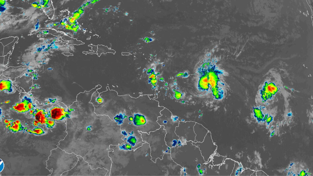
Bret is forecast to approach the Lesser Antilles through Thursday and then move across those islands late Thursday and Thursday night as a strong tropical storm, bringing a risk of flooding from heavy rainfall, strong winds, and dangerous waves along the coast.
Given the uncertainty in the track and intensity forecasts, it is still too early to specify the exact location and magnitude of where Bret’s associated hazards could occur. A Tropical Storm Warning is now in effect for St. Lucia, and a Tropical Storm Watch remains in effect for Barbados, Dominica, and Martinique. Additional warnings are likely for some islands in the Lesser Antilles later today (June 21).
Bret’s cloud pattern remains ragged, and cloud top temperatures have warmed a bit compared to earlier this morning (June 21). Since there has not been an appreciable increase in organization, the initial intensity remains 60 mph (50 knots), which is a blend between the latest subjective numbers from TAFB and SAB, and objective final-T numbers (which have been decreasing). An Air Force Reserve Hurricane Hunter aircraft is scheduled to investigate Bret in a few hours and should provide a better estimate of the storm’s intensity and wind field size.
The storm still appears to be under the influence of moderate westerly shear below the cirrus level, with the bulk of the deep convection displaced to the east of the center. Bret still has an opportunity to strengthen slightly over the next day or so, and the NHC intensity forecast is close to the SHIPS, LGEM, and HCCA solutions through 36 hours. Stronger deep-layer shear is expected to cause weakening in about 36 to 48 hours after Bret moves into the eastern Caribbean Sea, and global model fields indicate that the circulation could open up into a trough by Saturday. As a result, dissipation is now shown in the official forecast by day 4, although it could occur sooner than that.
Low- to mid-level ridging continues to push Bret westward at 280/12 knots. The steering flow is expected to strengthen some in the next couple of days, and Bret is therefore forecast to accelerate toward the west on Thursday and Friday as it’s approaching and passing across the Lesser Antilles. There have been no significant shifts in the track guidance on this cycle, and the new NHC track forecast is therefore unchanged from the 5 am forecast. Users are reminded that NHC’s track forecasts have average errors of about 45-50 nautical miles at 36 hours, and there is risk of strong winds and heavy rainfall for several islands within the Lesser Antilles regardless of exactly where the center crosses the island chain.


